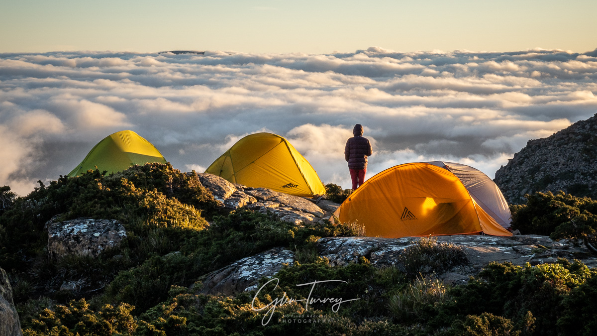
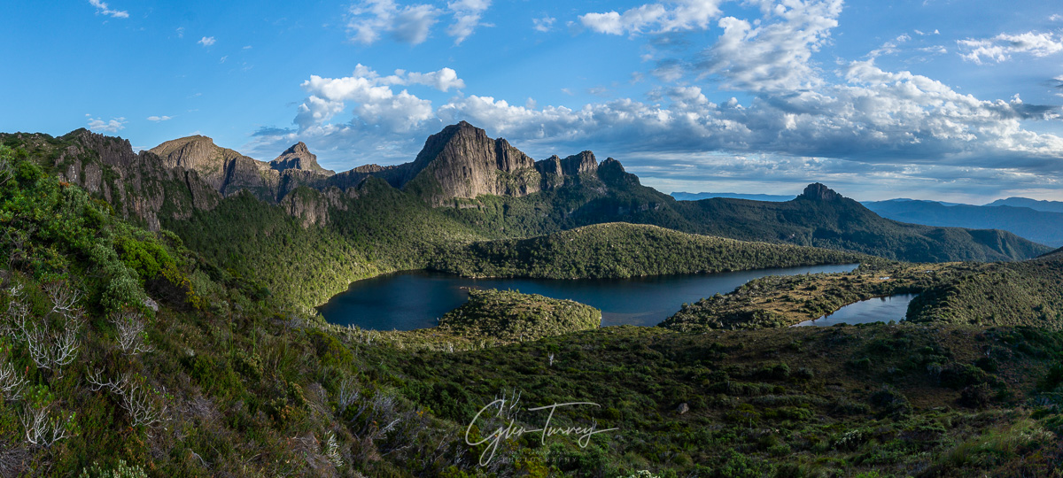
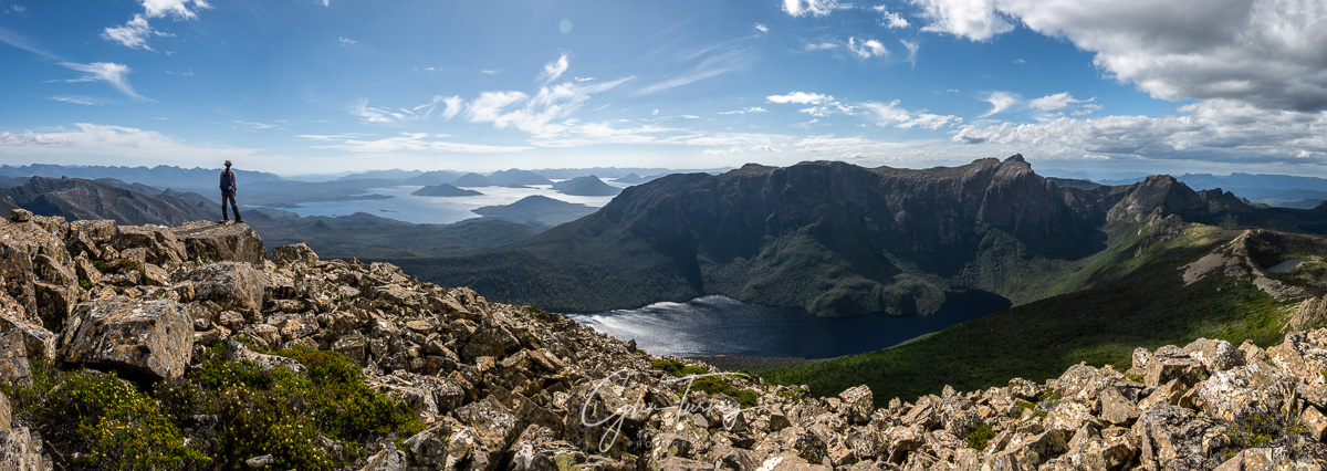
Mt Anne Circuit
A 3 to 4 day Tasmanian hiking adventure with some challenging rock scrambles and epic scenery.
Mt Anne Circuit
Overview
The Mount Anne Circuit is a world class challenging hike in remote South West Tasmania. Incredibly spectacular, the whole area is prone to bad weather making sections of the route impassable. So good planning, experience, and familiarity with South West Tassie are a must.
There are various rock scrambles along the route, most notably at the Mt Anne summit and a feature referred to as ‘the notch’ approaching lightning ridge. A little climbing experience goes a long way in these areas, and having someone in the group who’s done the route before is particularly beneficial, especially if you find your confidence flagging when faced with a daunting climb, exposure on cliff edges, or navigating tricky terrain.
Tasmanian Parks & Wildlife Service (TPWS) provides excellent information on the circuit here, and summarises by saying ‘Only VERY experienced walkers should attempt this track.’
On This Page…
Map
The ‘circuit’ as such is a 3 to 4 day loop of about 27 km from the car park as shown in the lower section of the map. The alternative spur to the north (Mt Anne’s North East Ridge) is an untracked and non-preferred approach we’ve taken once.
In all cases the loop is incomplete, and unless you go back the way you came, you end up on the road many kilometres from where you started. So an additional car, additional walking, or hitchhiking are required to get back to your car. We’ve always managed to do the latter, though walking in the off season or bad weather may lead to a wet and lonely 10 km of more walking the roads.
We’ve met experienced mountain trail runners completing the track in a day, and those taking 10 days in the area. But we’ve always made a 4 day trip, with enough food for an extra night if required.
For more details see TPWS track notes here.
Images
It’s a spectacular place. You can buy prints of our most popular South West Tasmania images.
And don’t forget to check out our Gallery of Tasmania.
Getting There
- Book your spot. TPWS have introduced a booking system to limit numbers on various tracks and at camp sites around Tasmania. In general this is a good thing, but before you do too much planning, make sure you can book the dates you’re after.
- Arrange transport. There are irregular shuttle buses and various hiker transport services in Tasmania, but there are no regular public transport options to get to the trail heads. If you want some flexibility it’s best to have your own transport.
- Work out how you’ll get back to your car. Some folks leave a bicycle to assist, others have two cars, you can walk back to your car, or hitchhike. The best option depends on your specific situation and circumstances. In all cases we’ve been prepared to walk, but have found a helpful person to give us a lift.
Car Park - Shelf Camp (inc. Mt Anne Summit)
Eliza Ridge
From the car park you ascend around 1,000m to cross the Eliza Plateau before making a short descent to the Shelf Camp. There’s the option to drop packs and make the somewhat exposed rocky scramble to the summit of Mount Anne. We’ve found about half the folks reaching the base of the Mt Anne summit did not feel comfortable going up. It just depends how confident you are with a few climbing moves on exposed rock, without protection.
The summit offers stunning views across the south west, being not only the highest but also one of the most isolated peak in the area.
The North East Ridge
We have also ascended via the North East Ridge which offers diverse and dramatic scenery. However this is an untracked and non-preferred route. Those wishing to tackle this approach would do well to contact TPWS for advice.
Shelf Camp
The shelf camp is a small glacial rock shelf with a tub style toilet that can be flown out by helicopter. The unprotected tub offers excellent views and all weather experience.
The camp site is quite exposed with limited anchoring options for tents. So windy conditions are best avoided, noting that they can arrive un-forecast anyway so be prepared.
Shelf Camp - Lonely Tarns (via Lightning Ridge)
The Lonely Tarns are reached via an unlikely route across Mt Lot, via Lightning Ridge. It’s only a short distance, but the terrain makes for slow going climbing up and down various rock and boulder routes, including a feature called ‘the notch’ for which a pack hauling rope can be a real advantage.
We’ve found this to be a really fun day. Route finding, uncertainty about the way (not to mention our abilities), a bit of adrenalin on exposed rock faces, and stunning views all combine to make for a sense of adventure and achievement at the end of the day.
Side Trip to Lots Wife
Lots Wife can be seen from various parts of the circuit as a spectacular isolated slender column. A side trip to the pillar will take 4 to 5 hours from the Lonely Tarns. It’s not far, but the going is slow through dense vegetation with the final ascent to the summit up a steep exposed rock chute on the northern face.
The final approach to the pillar is really spectacular.
After dodging through ancient King Billy Pine forest, the route presses into dense vegetation on the ridge between Mt Lot and Lots Wife before finally opening out to a clearer path on approach to the pillar.
It took us about 2 hours to get from the Lonely Tarns to the base of the pillar. We found the final ascent to be trickier than Mt Anne summit and the notch, so did not summit on this occasion. Preferring to use the time at the end of the day to climb Mt Sarah Jane.
Lonely Tarns - Judd Lake Car Park (via Mt Sarah Jane)
As you depart the Lonely Tarns the track ascends towards the base of the Mt Sarah Jane summit. Looking back towards the tarns you get stunning views of Eve Peak, Mt Anne, Mt Lot, and Lots Wife.
Surprisingly few people climb Mt Sarah Jane, likely because it comes at the end of some challenging days, and within a few hours of the car park. I expect folks can smell the coffee by this stage and are in a hurry to get home. We had been on some trips, but on one occasion we camped immediately below the summit peak of Mt Sarah Jane and made a sunset trip to the summit.
The views were far more spectacular than Lots Wife, and it’s far more accessible. A highly recommended side trip if the weather permits.
Further Reading & Helpful Links
There is a high level of detail provided in the TPWS track notes, which also includes links to their booking platform:
Disclaimer
These are simply notes from our own travel and trips which we hope others will find helpful. They are intended to be neither a guide nor recommendation. You should do your own research before attempting to access these areas yourself, and manage your own safety. Check out our detailed disclaimer here.
Leave a reply